
Block Model (Raw Data)
A Block Model entity stores structured 3D block data—typically used in resource estimation, geological modeling, and spatial analysis. The model is uploaded as a comma-separated ASCII text file, where each row represents an individual block.
Import structured block models in CSV format. Each row represents a volumetric block with positional and attribute data.
→ Commonly used in mining and geological modeling.
Uploading a Block Model
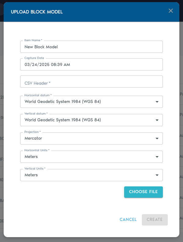
3. Fill out the following fields:
|
Field |
Description
|
|
Item Name |
A descriptive name for the new block model entity. |
|
Capture Date |
(Optional) The original date the model data was captured.
|
|
CSV Header |
A comma-separated line of headers that define how each column in the block model should be interpreted. (Details below.)
|
|
Horizontal Datum |
The horizontal reference system used in the model. |
|
Vertical Datum |
The vertical reference system used for elevation values.
|
|
Projection |
The map projection used in the dataset.
|
|
Horizontal Units |
Units for X and Y coordinates (e.g., meters, feet).
|
|
Vertical Units |
Units for Z coordinates (e.g., meters, feet). |
CSV Header
The CSV Header field defines how each column in your file should be interpreted. For example, a header line like:
XC,YC,ZC,XL,YL,ZL,AU,CU
…will produce a list of Column Definitions for each value, allowing you to specify their role in the model.
|
|
|
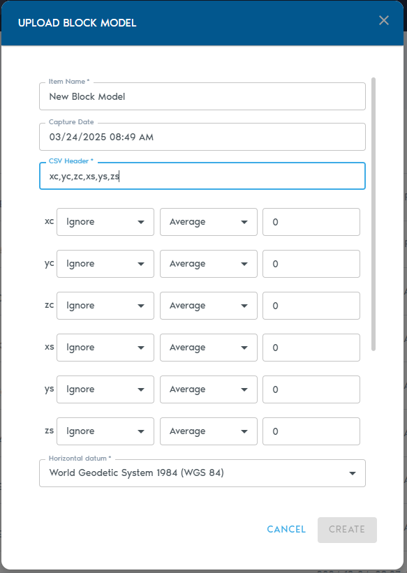
Column Types
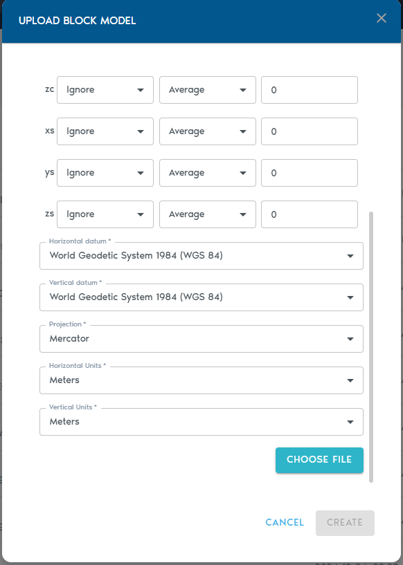
Each column must be assigned a Type, which tells the system how to process it:
|
Type |
Purpose
|
|
Ignore |
Exclude this column from processing.
|
|
Set |
The column contains a small set of repeating categorical values. |
|
Value |
Numeric values (e.g., grades, densities).
|
|
Block Centroid X/Y/Z |
Coordinates for the block’s center point.
|
|
Block Origin X/Y/Z |
Coordinates for the block’s origin corner.
|
|
Block Dimension X/Y/Z |
Size of the block along each axis.
|
Note: You must choose either block centroids or block origins for positioning—not both. Using both will result in an input error.
Level of Detail (LOD) Aggregation
Each numeric column (e.g., grades or quantities) can also be configured with a Level of Detail (LOD) operation, which determines how values are aggregated in lower-resolution views:
|
LOD Option |
Description
|
|
Average |
Average of all higher-resolution values.
|
|
Min |
Minimum value from the finer data.
|
|
Max |
Maximum value from the finer data.
|
|
Add |
Sum of all values (ideal for counters).
|
|
Multiply |
Product of all values. |
Uploading the File
- Click “Choose File” to upload your block model file (CSV or TXT format).
- You may also upload a ZIP archive that contains your ASCII file.
Click “Create” to start the upload process. You can monitor the progress in the project’s “Pending” section.