
Data Export
The VoxelSpace platform provides a user-friendly way to export spatial data in standard formats for use outside the system. The Export entity is used to define and execute an export job, and it also stores the results for later download.
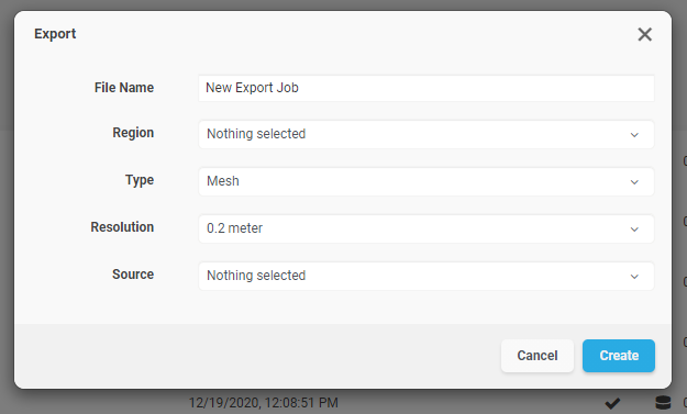
Creating a Data Export
- In your project’s Catalog, click “Add Object” and select “Voxel Generator.” (This is the current interface label for launching export jobs.)
3. Complete the configuration fields:
|
Field |
Description
|
|
File Name |
A readable name for the export job. This will also be used as the exported file name when downloaded.
|
|
Region |
Select the region of interest from the list of available project regions. This defines the spatial area for the export.
|
|
Type |
Choose the data format for export: <ul><li>Mesh – Exports surface data as an .OBJ file</li><li>Points – Exports point cloud data as a .CSV file</li><li>Raster – Exports ortho-imagery as .TIFF with accompanying .TFW (world file)</li></ul>
|
|
Resolution |
Choose the resolution level for the export. You may export at full (1:1) density or select a lower resolution depending on your use case.
|
|
Source |
Select the dataset to be exported. This option is context-sensitive and will show compatible sources based on the selected export type. |
Running and Downloading the Export
- Click “Create” to initiate the export process.
- You can monitor the export status in the project’s “Pending” section.
- Once processing is complete, go to the Project Catalog and click the “Download” button next to the Export entity to retrieve your data.