
Ortho-Imagery (Raw Data)
The Ortho-Imagery entity stores a set of georeferenced images—typically aerial or satellite imagery—used for detailed mapping, visualization, or terrain analysis.
Add georeferenced aerial imagery with associated world files (e.g., JPG + JGW). Supports bulk uploads via ZIP.
→ Ideal for surface visualization and texture mapping.
Uploading Ortho-Imagery
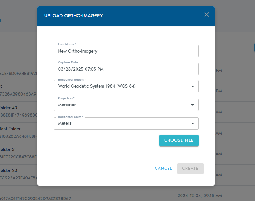
3. You’ll be prompted to provide the following metadata:
|
Field |
Description
|
|
Item Name |
A readable, descriptive name for the new imagery set.
|
|
Capture Date |
(Optional) The original date when the imagery was captured.
|
|
Horizontal Datum |
The horizontal datum used in the world registration files (e.g., WGS 84, NAD83).
|
|
Projection |
The projection used by the world registration files.
|
|
Horizontal Units |
Units used in the registration files (typically meters or feet). |
Uploading Files
· Click “Choose Files” to select the image files you wish to upload.
· Each image must have a corresponding world file for proper georeferencing.
· You can also upload ZIP archives that contain both images and their associated world registration files.
|
Image Format |
Expected World File Extension |
|
.JPG |
.JGW |
|
.PNG |
.PGW |
|
.BMP |
.BPW |
|
.TGA |
.TAW |
|
.TIF |
.TFW |
4. Once your files are selected, click “Create” to begin the upload process.
5. You can track the progress of your upload in the “Pending” section of the project’s page.