
Ortho-Imagery
ThisThe Ortho-Imagery entity stores a set of images,georeferenced images—typically aerial imagery.or satellite imagery—used for detailed mapping, visualization, or terrain analysis.
OnceUploading youOrtho-Imagery
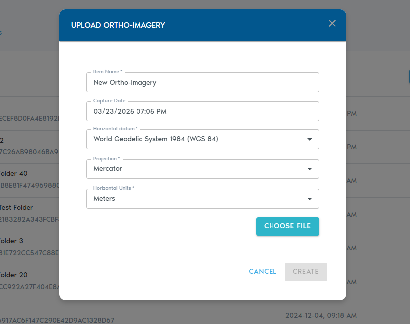
3. You’ll be prompted to provide the following metadata:
|
Field |
Description
|
|
Item Name |
A
|
|
Capture Date |
|
|
Horizontal Datum |
The horizontal datum used in the world registration files (e.g., WGS 84, NAD83).
|
|
Projection |
The projection used by the world registration
|
|
Horizontal Units |
|
Uploading Files
· Click “Choose Files” to select whichthe image files you wish to uploadupload.
· the Ortho-Imagery set. Each image in the set is expected tomust have a matchingcorresponding world file for proper georeferencing.
· You can also upload ZIP archives that contain both images and their associated world registration file. The following table lists the supported image formats and the expected world file extension for the format:files.
|
Image Format |
Expected World File Extension |
|
|
|
|
. |
. |
|
. |
. |
|
. |
. |
|
. |
|
| .TFW |
4.
Once Youyour canfiles alsoare selectselected, multipleclick archive ZIP files, which should contain the image and matching world registration files.
Click on “Create” to begin the upload process.
5. You can track the progress of your upload operation fromin the “Pending” section inof the project’s page.