
Point Cloud
ThisA Point Cloud entity stores a raw pointspatial cloud.data Thiscollected isfrom howsources such as LiDAR or photogrammetry. Uploading point clouds areinto uploadedVoxelSpace intois the systemfirst forstep latertoward processing.visualizing and processing high-resolution terrain or structure data.
FirstUploading goa Point Cloud
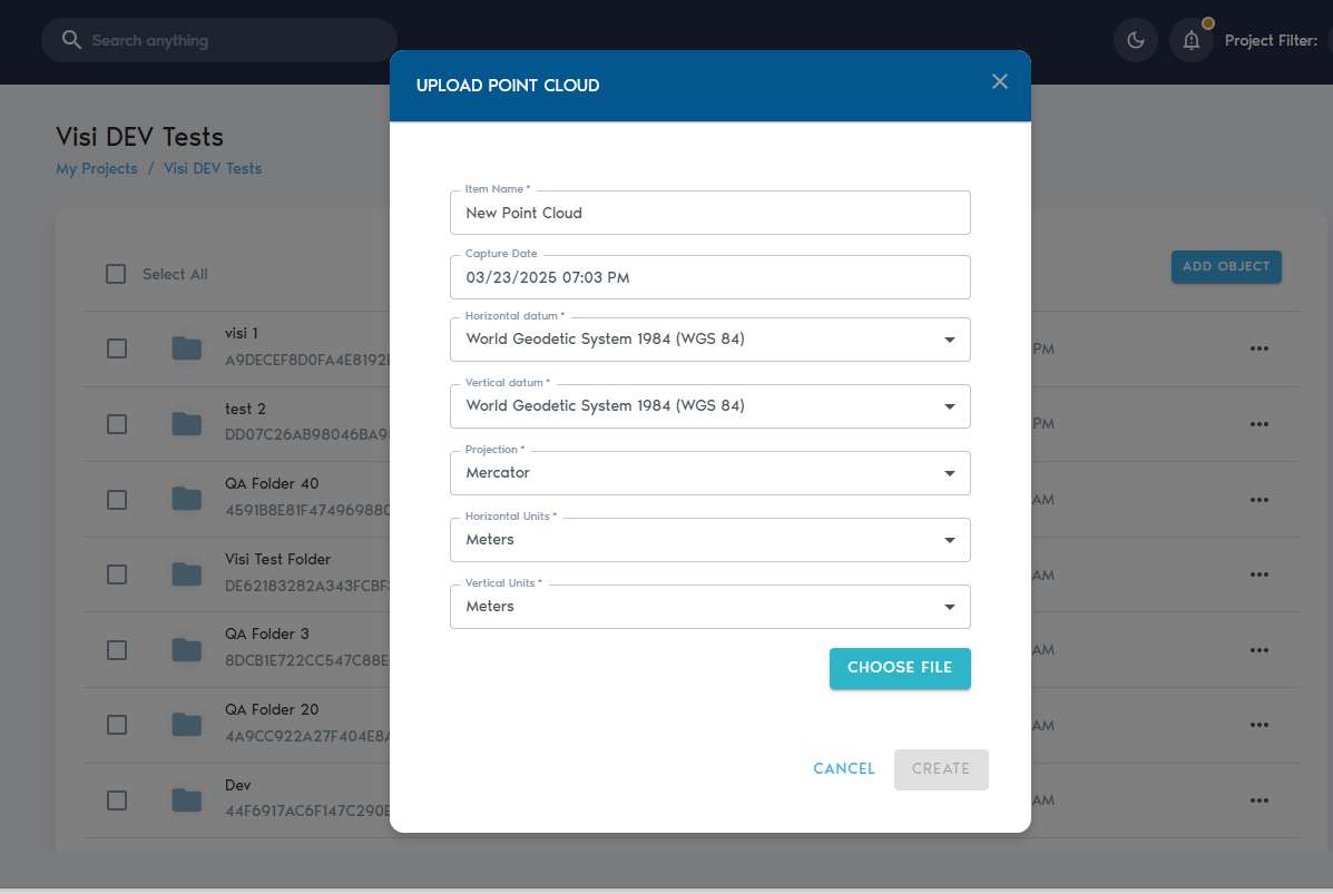
4. You’ll be prompted to enter the following details:
|
Field |
Description
|
|
Item Name |
A descriptive, readable name for the new
|
|
Capture Date |
|
|
Horizontal Datum |
|
|
Vertical Datum |
|
|
Projection |
|
|
Horizontal Units |
|
|
Vertical Units |
|
5. After entering the required metadata, click “Choose Files” to upload your data.
You can select multiple files during upload. The platform currently supports the following formats:
- Text files (ASCII) with comma- or space-separated values
- LAS files
- LAZ files
- ZIP archives containing any of the above formats
6. Once youfiles haveare provided values to these fields,selected, click on “Choose Files”. This will prompt a file selection dialog where multiple files can be selected for uploading. The following file types are currently supported:
Text Files (ASCII) with comma or space separated values.LAS filesLAZ filesZIP archive files containing compressed Text, LAS or LAZ files.
Click on “Create” to begin the upload process.
You can trackmonitor the upload operationprogress from the “Pending” section inwithin the project’sselected page.project.