
Point Cloud
A Point Cloud entity stores raw spatial data collected from sources such as LiDAR or photogrammetry. Uploading point clouds into VoxelSpace is the first step toward visualizing and processing high-resolution terrain or structure data.
Uploading a Point Cloud
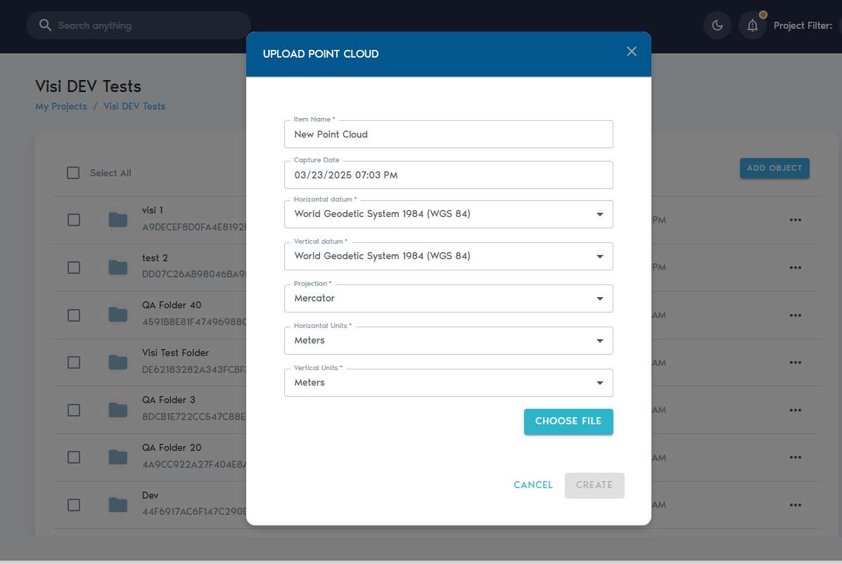
4. You’ll be prompted to enter the following details:
|
Field |
Description
|
|
Item Name |
A descriptive, readable name for the new point cloud entity.
|
|
Capture Date |
(Optional) The original date the point cloud data was collected.
|
|
Horizontal Datum |
The horizontal reference system used (e.g., WGS 84, NAD83).
|
|
Vertical Datum |
The vertical reference system used for elevation or depth.
|
|
Projection |
The coordinate projection applied to the dataset.
|
|
Horizontal Units |
Units used for horizontal measurements (e.g., meters or feet).
|
|
Vertical Units |
Units used for vertical measurements (e.g., meters or feet). |
5. After entering the required metadata, click “Choose Files” to upload your data.
You can select multiple files during upload. The platform currently supports the following formats:
- Text files (ASCII) with comma- or space-separated values
- LAS files
- LAZ files
- ZIP archives containing any of the above formats
6. Once files are selected, click “Create” to begin the upload process.
You can monitor the upload progress from the “Pending” section within the selected project.