Introduction
You can use the VoxelSpace WebUI to add a wide range of spatial entities—including point clouds, block models, terrain, meshes, and more. These entities serve as the foundation for analysis, visualization, collaboration, and reporting within your project.

GettingAdd StartedSpatial Entities
To add new spatial data toInside your project:
project,
Navigate to the Project Page.
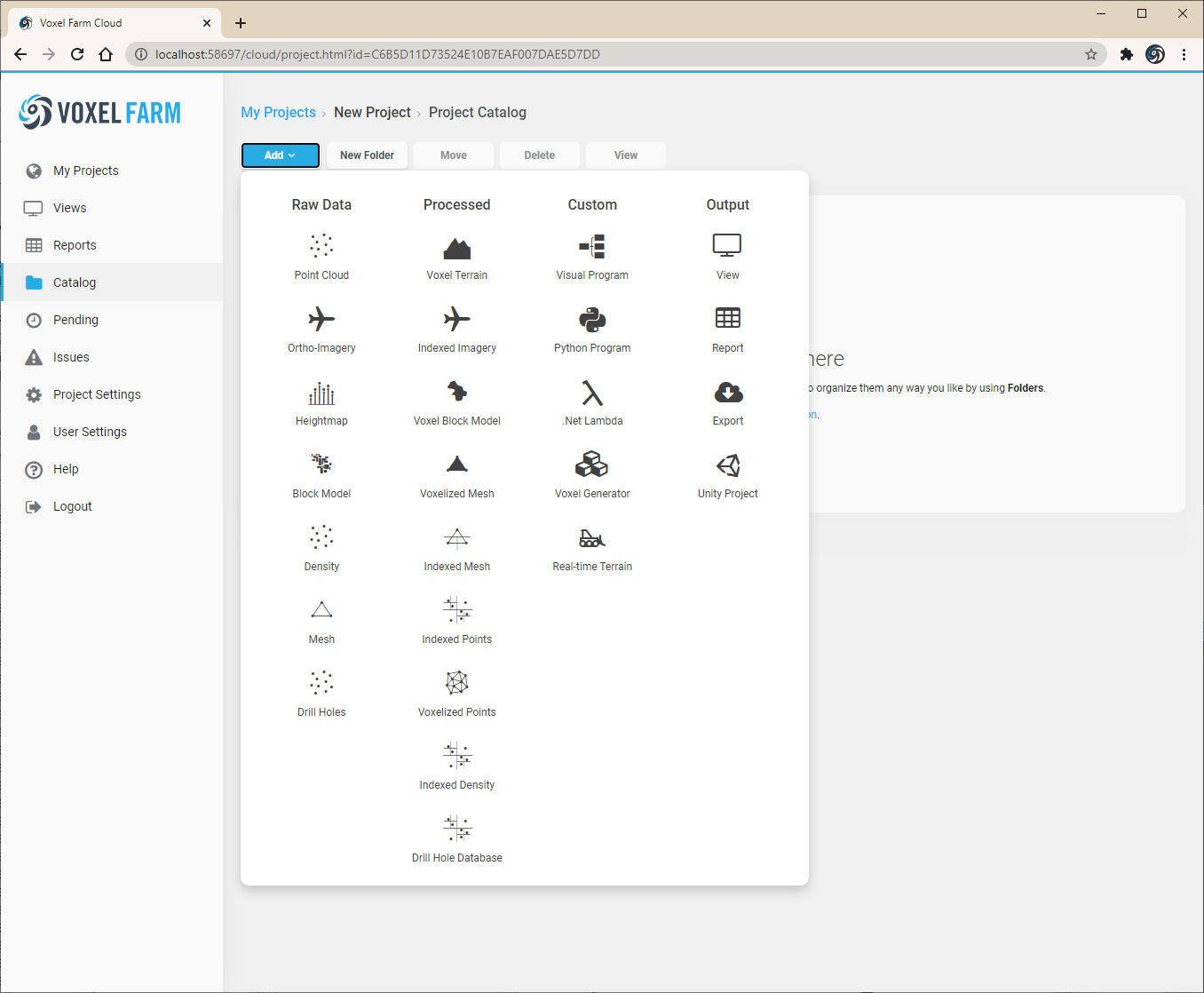
Open the Catalog section from the left-hand menu.
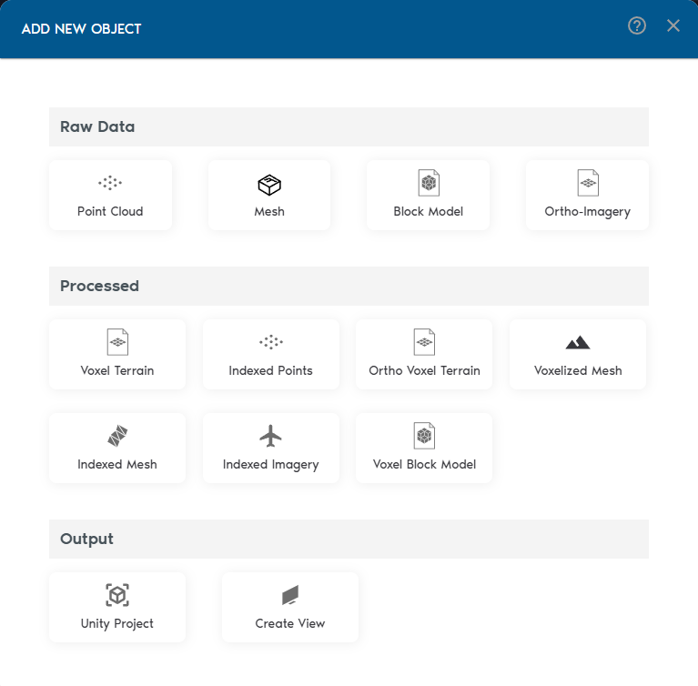
Click on theclick “Add Object” button to viewbegin adding spatial entities. VoxelSpace supports a listwide range of supportedinput entityformats:
types.
- Point Clouds
SelectMeshes (OBJ/FBX)- Block Models
- Ortho-Imagery
- Process Your Raw Data
Once your raw data is in the entitysystem, typeVoxelSpace lets you wishconvert toit create,into thenoptimized followformats for analysis and visualization. These include:
- Indexed Mesh
- Indexed Point Cloud
- Voxel Terrain
- Voxel Block Model
- Voxelized Mesh
- Ortho Voxel Terrain
- Voxelized Points
Choose the promptsformat tothat enterfits metadatayour use case—whether it's simulation, comparison, or rendering.
- Create a View
Views are where VoxelSpace truly shines. With a View, you can combine multiple datasets into a 3D scene, configure visual styles, explore cross-sections, and uploadshare relevantinsights files.with your team.
Views are collaborative, reusable, and can be saved or shared across your organization.
select
the
desired entity type from this list, the page will prompt for additional information.