Project Coordinate System
Use the “Coordinates” section when creating or editing a project to define its units, reference systems, and spatial framework.
These settings are essential for aligning all spatial data correctly within your project and ensuring consistency across datasets.
|
Field |
Description
|
|
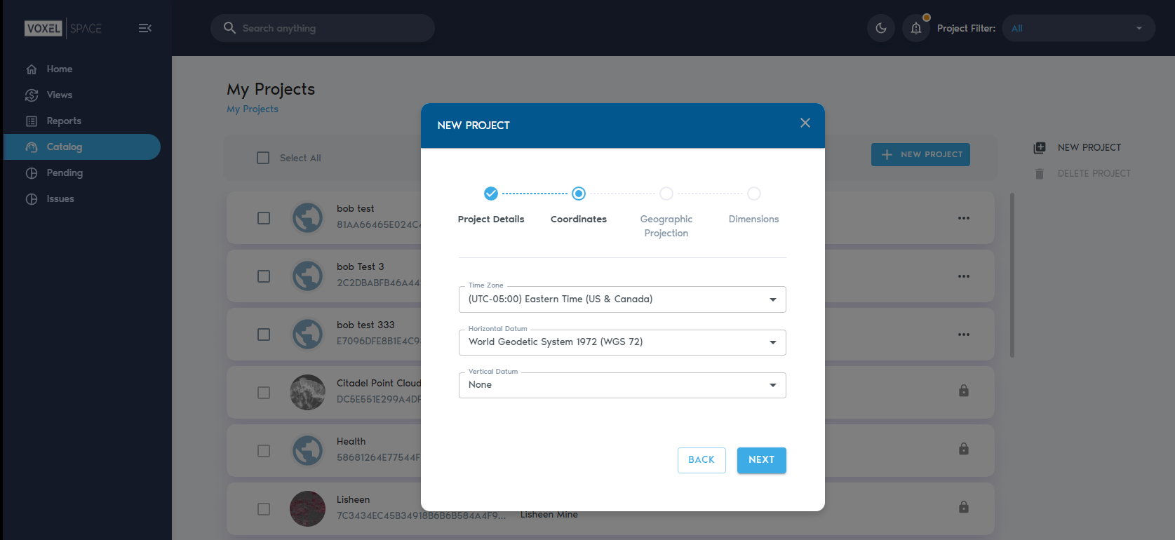
Time Zone |
Sets the local time zone for the project location. This helps timestamp data and coordinate updates across time-based processes.
|
|
Horizontal Datum |
A horizontal datum defines how latitude and longitude coordinates are calculated based on the shape of the Earth. VoxelSpace supports the following horizontal datums:
|
|
Vertical Datum |
A vertical datum sets the reference surface used to measure elevation or depth. VoxelSpace supports the following vertical datums:
|
|
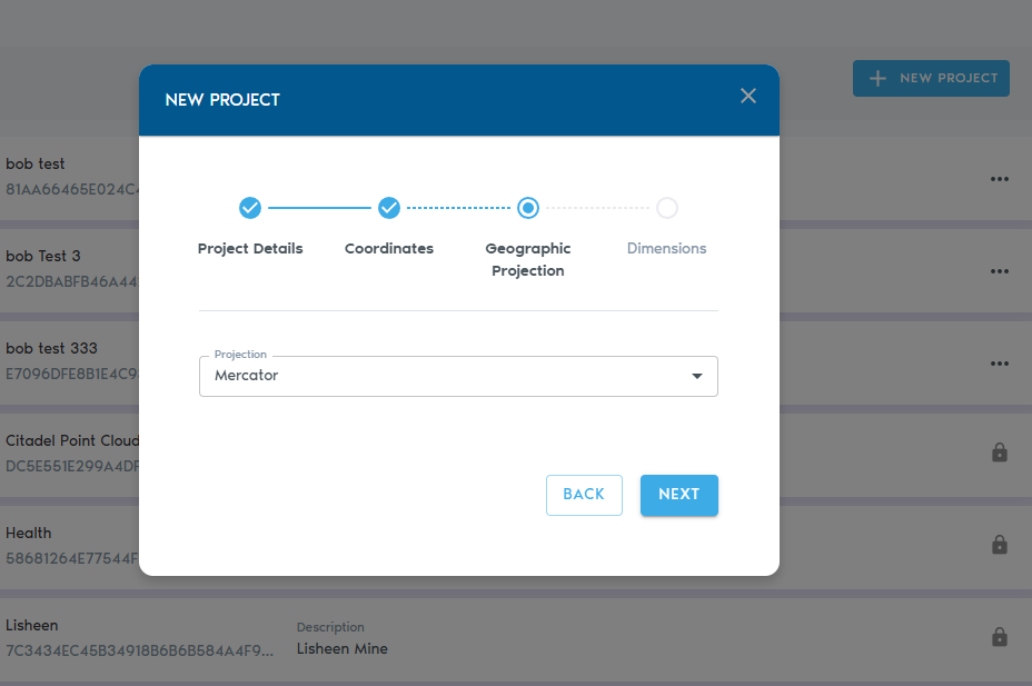
Projection |
Defines the map projection used to represent the Earth’s curved surface in 2D/3D space. Supported projections include:
|
|
Units |
Choose whether your project uses meters or feet for all distance measurements.
|
|
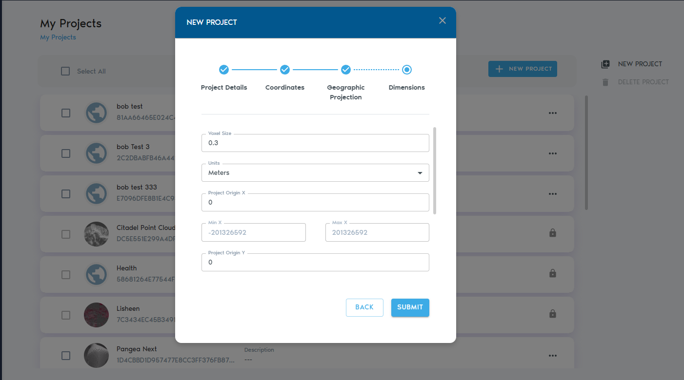
Voxel Size |
Voxels are 3D cubes. This setting defines the edge length of each voxel (in project units).
|
|
Project Origin (X, Y, Z) |
The origin point of the project’s coordinate space. All spatial data will be referenced relative to this point.
|
|
Min X, Y, Z (Read-only) |
The minimum bounds of the coordinate system in each axis. Calculated automatically.
|
|
Max X, Y, Z (Read-only) |
The maximum bounds of the coordinate system in each axis. Calculated automatically.
|
Next Steps
After setting the coordinate system, click “Next” to continue defining the dimensions and spatial extent of your project.