Project Coordinate System
Use the “Coordinates” section to configure the units and projection system used by the project.
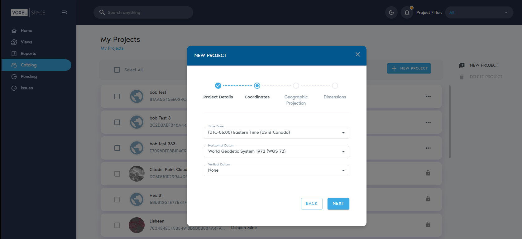
The following table lists the properties found in the Coordinates section and describes their use:
A horizontal datum is a reference system used to define positions on the Earth's surface using latitude and longitude. It's essentially a coordinate system that helps pinpoint locations geographically. This system relies on a mathematical model of the Earth's shape, often an ellipsoid, and a specific anchor point.
A vertical datum is a reference surface used to define vertical positions, essentially serving as the "zero point" for measuring elevations and depths on Earth. It's crucial for consistent and accurate height measurements in various fields like surveying, hydrography, and navigation.
|
Time Zone |
The time zone for the project’s location. |
|
Horizontal datum |
Horizontal datum used by the project. These are the supported horizontal datums:
|
|
Vertical datum |
Vertical datum used by the project. These are the supported vertical datums:
|
|
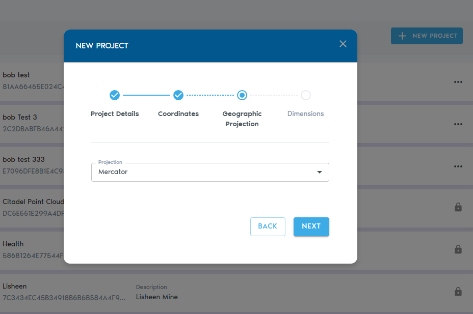
Projection |
Projection used by the project. These are the supported projections:
|
|
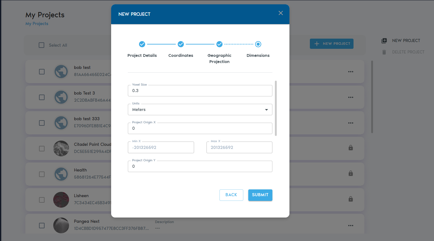
Units |
Determines whether units represent meters of feet. |
|
Voxel Size |
Voxels are cubes. This parameter determines the length all sides in a voxel’s cube. |
|
Project Origin X, Y, Z |
The origin coordinates of the project, in units. This point becomes a reference point for the project. |
|
Min X, Y, Z (read-only) |
Minimum possible coordinates in the project. |
|
Max X, Y, Z (read-only) |
Maximum possible coordinates in the project. |
The next page is about the geographic Projection
Click on next to add the dimensions of your project