Mesh (Raw Data)
A Mesh entity stores raw 3D surface geometry, such as terrain models, structural designs, or scanned objects. VoxelSpace currently supports mesh uploads in the FBX and OBJ formats.
→ Useful for infrastructure, CAD designs, and high-detail scanned models.
Uploading a Mesh
- In your project’s Catalog, click “Add Object.”
- Select “Mesh” from the dropdown menu.
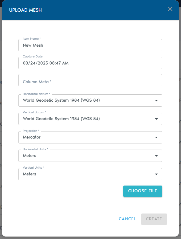
3. Fill in the required metadata fields:
|
Field |
Description
|
|
Item Name |
A clear, descriptive name for the mesh entity.
|
|
Capture Date |
(Optional) The date the mesh was captured or created.
|
|
Horizontal Datum |
The horizontal reference system used in the mesh.
|
|
Vertical Datum |
The vertical reference system used for elevation.
|
|
Projection |
The coordinate projection applied to the dataset.
|
|
Horizontal Units |
Units for X and Y coordinates (e.g., meters or feet).
|
|
Vertical Units |
Units for Z coordinates (e.g., meters or feet). |
Note: The system assumes that all vertex coordinates in the mesh are already aligned with the project’s coordinate space. For this reason, it does not require separate transformation or alignment settings during upload.
Uploading Files
- Click “Choose File” to select your .FBX or .OBJ mesh file.
- You may also upload a ZIP archive containing the mesh and any associated assets (e.g., textures).