Indexed Point Cloud (Processed)
An Indexed Point Cloud is a spatially-processed version of a raw Point Cloud entity. By applying the project’s spatial index, this format enables fast visualization, filtering, and integration with other spatial datasets in VoxelSpace.
Creating an Indexed Point Cloud
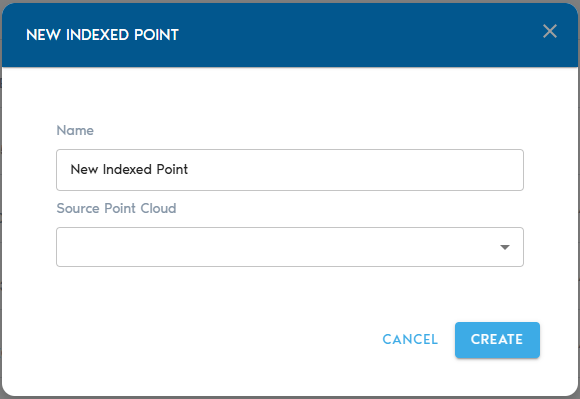
3. Complete the required fields:
|
Field |
Description |
|
Item Name |
A clear, descriptive name for the new Indexed Point Cloud entity. |
|
Source Mesh |
Select a raw Point Cloud from the list. This will serve as the input for the indexing process. |
Indexing the Point Cloud
- After selecting your source and providing a name, click “Create” to initiate the indexing process.
- You can monitor the progress in the project’s “Pending” section.
Viewing the Indexed Point Cloud
Once processing is complete:
- Use the “View” button next to the Indexed Point Cloud in the Catalog to open and explore it.
- Alternatively, you can create a View entity and designate the Indexed Point Cloud as its data source for broader analysis and visualization.