# Adding Layers to a View

In VoxelSpace, a **View** can contain one or more **visual layers**, each representing a different dataset or spatial element. Layers are essential for building rich, multi-dimensional visualizations that combine terrain, point clouds, block models, and more.

<div align="center" class="MsoNormal" id="bkmrk-" style="text-align: center;">---

</div>**How to Add a Layer**

<span class="rvts6"><span style="font-size: 11.0pt; line-height: 107%; font-family: 'Aptos',sans-serif; mso-ascii-theme-font: minor-latin; mso-fareast-font-family: Aptos; mso-fareast-theme-font: minor-latin; mso-hansi-theme-font: minor-latin; mso-bidi-font-family: 'Times New Roman'; mso-bidi-theme-font: minor-bidi; mso-ansi-language: EN-CA; mso-fareast-language: EN-US; mso-bidi-language: AR-SA;">1. While in the **View interface**, click the **Layer icon**</span> </span>[![image.png](https://help.mystart.com/uploads/images/gallery/2025-03/scaled-1680-/oQKimage.png)](https://help.mystart.com/uploads/images/gallery/2025-03/oQKimage.png) to open the **View Configuration Panel**.

2\. In the panel, select the **“Layers”** tab.

<span style="font-size: 11.0pt; line-height: 107%; font-family: 'Aptos',sans-serif; mso-ascii-theme-font: minor-latin; mso-fareast-font-family: Aptos; mso-fareast-theme-font: minor-latin; mso-hansi-theme-font: minor-latin; mso-bidi-font-family: 'Times New Roman'; mso-bidi-theme-font: minor-bidi; mso-ansi-language: EN-CA; mso-fareast-language: EN-US; mso-bidi-language: AR-SA;">3. Click the **“Add Layer…”** button to begin adding data to the View.</span>

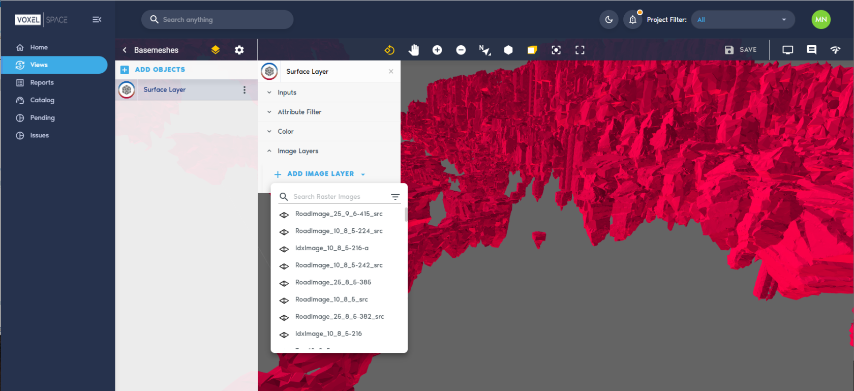
[![image.png](https://help.mystart.com/uploads/images/gallery/2025-03/scaled-1680-/mNJimage.png)](https://help.mystart.com/uploads/images/gallery/2025-03/mNJimage.png)

**What Happens Next?**

After clicking **“Add Layer…”**, you’ll be prompted to:

- **Select a dataset** from the project’s catalog
- **Configure how it’s rendered**, including visibility, transparency, color maps, or display filters—depending on the dataset type

Each dataset you add enhances the View, allowing for layered analysis and deeper spatial understanding.